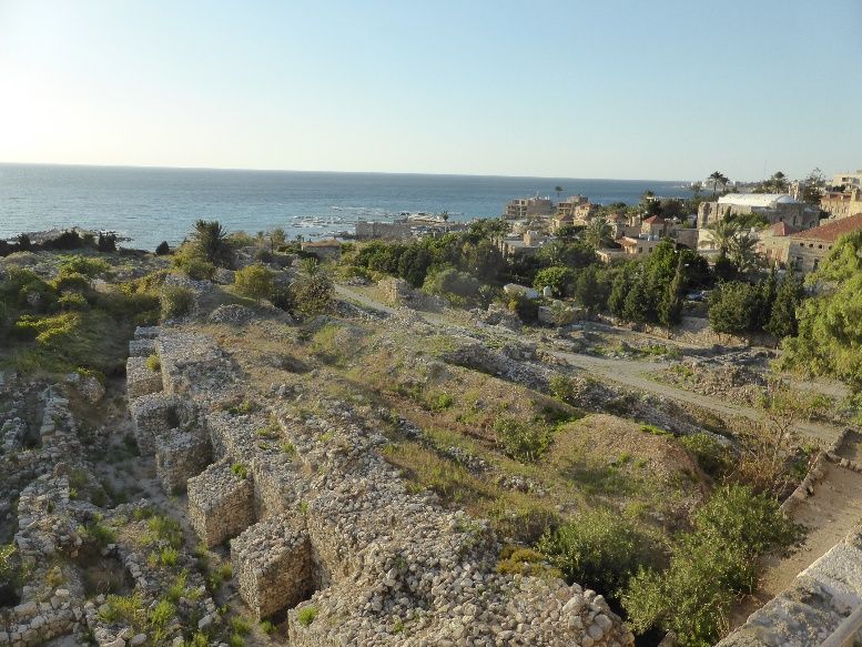
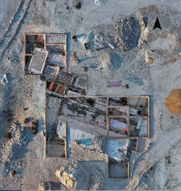
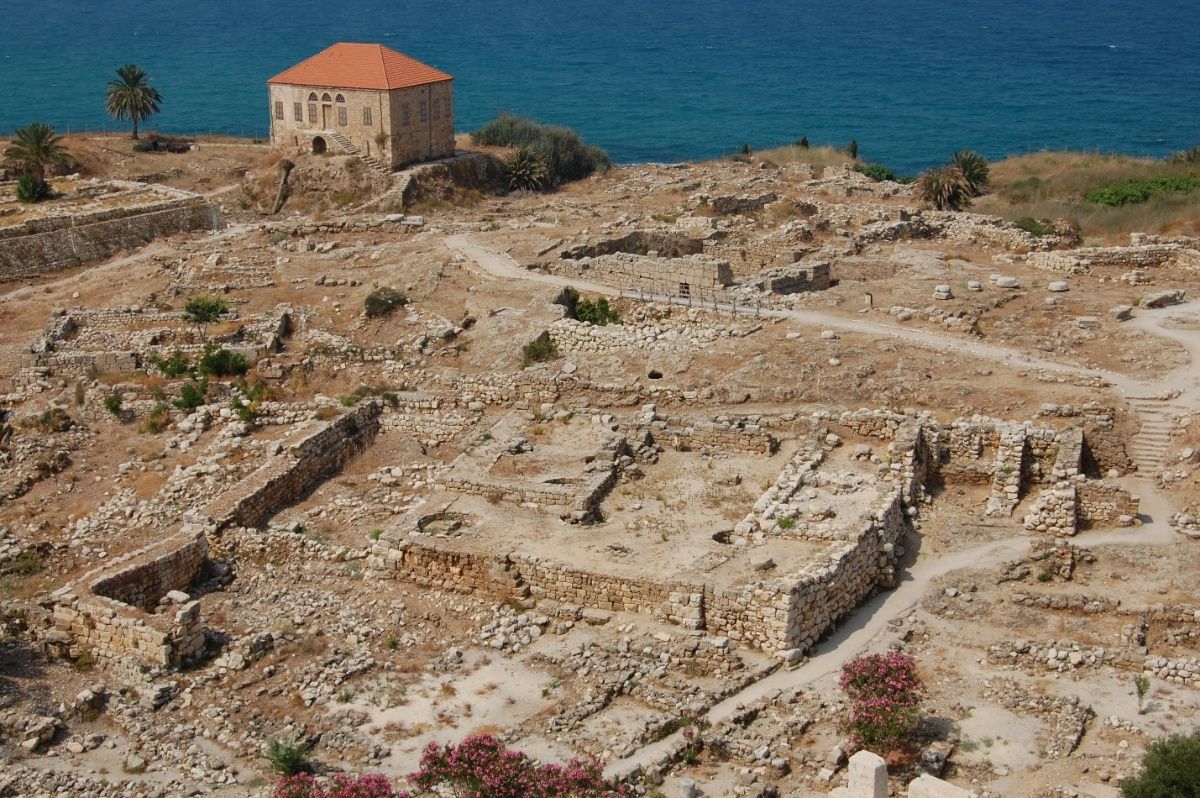
Baalat Gebal Temple dedicated to the chief goddess of Byblos. Photo: Hanan Charaf.

Byblos and the Making of an Ancient Maritime Hub

June 2026 | Vol. 14.6

By Hanan Charaf and Martine Francis-Allouche

The authors dedicate this article to the heritage of Lebanon, which remains under grave threat in the latest war, and to the people working tirelessly to protect it.

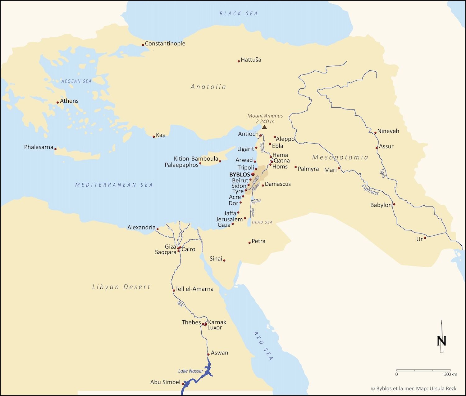
The ancient site of Byblos (modern Jbeil), known as Gubla in Akkadian, Kpn in Egyptian, and Gbl in Phoenician, developed into one of the most enduring and influential centers of the ancient Near East. This modest settlement of six hectares located on the Lebanese coast approximately 40km north of Beirut, became, over the course of millennia, a key place in a vast web of exchange linking the ancient Near East to Egypt and beyond.
Map of Lebanon and the Mediterranean world with ancient place names. Map: Ursula Rezk. © Archives Byblos et la mer.

Its history is not one of imperial conquests or territorial expansion. Rather, it is a story of interconnectedness, that of a city that flourished through its ties with other regions and powers. Byblos occupied a liminal position between inland routes — the Bekaa Valley leading to Syria and Mesopotamia — and maritime routes extending along the Levantine coast into the broader Mediterranean. This position allowed it to function as a gateway: goods could arrive from distant regions, be redistributed, and continue their journey.

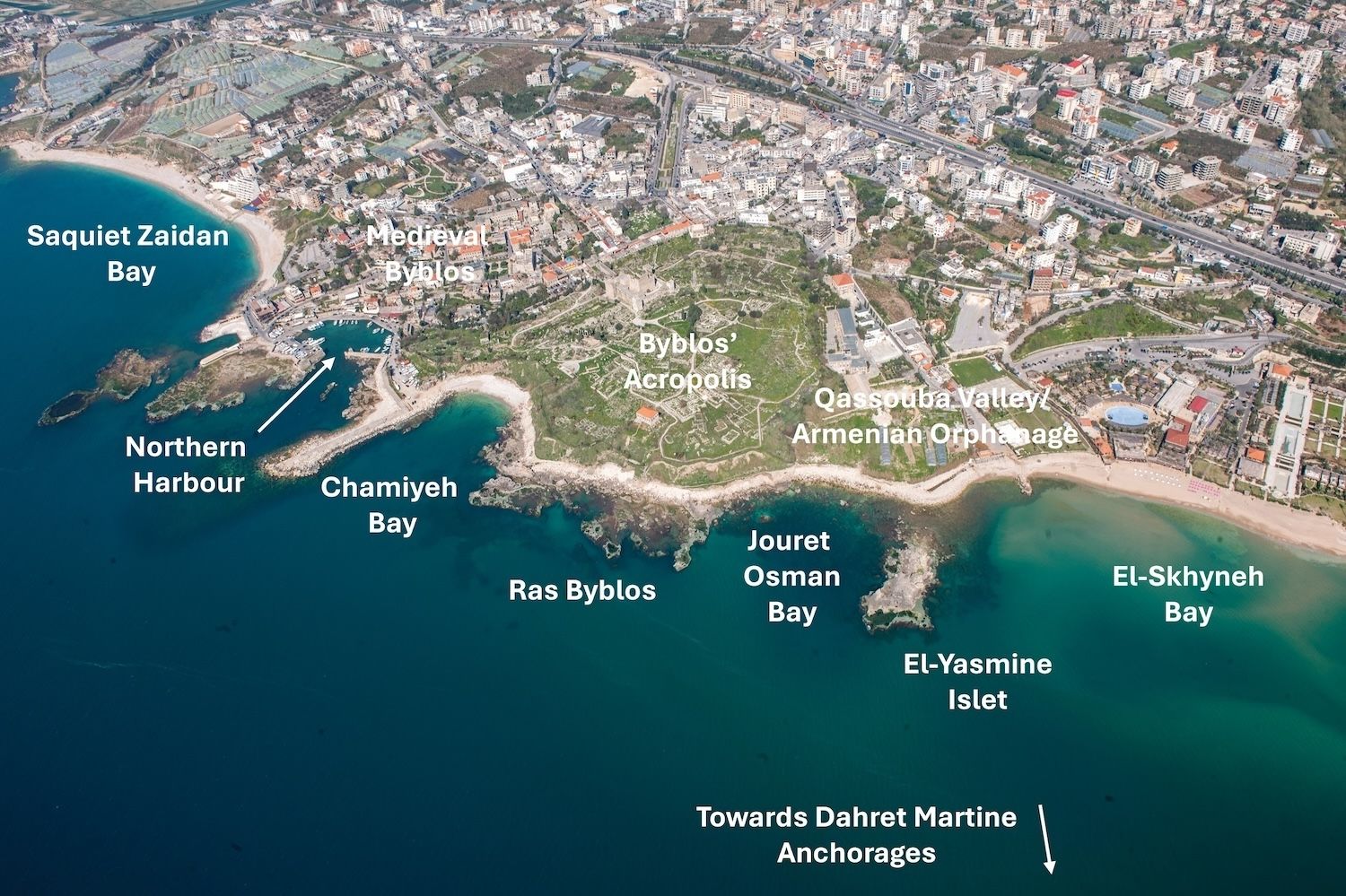
One thing certain is that the rise of Byblos cannot be understood apart from its geography. The site, situated on a sandstone promontory, offered natural advantages favorable for a permanent settlement: access to a water point and two sheltered anchorages, and proximity to fertile hinterlands and Mount-Lebanon forests where the famous cedrus libani and other conifers grew.

Aerial photograph of the archaeological site of Byblos, showing the location of the northern and southern harbors. Photo Rami Yassine. © Archives Byblos et la mer.

From an early date, these features attracted settlement, and by the Neolithic and Chalcolithic periods, a fishing community had already established itself on the site. By the end of the fourth millennium BCE, however, something had changed. The small settlement evolved into a fortified city-state during the Early Bronze Age to accommodate a millennia-long timber trade primarily with ancient Egypt. Indeed, the Nile Valley lacked suitable timber for large-scale construction and Egyptian rulers depended on external sources for shipbuilding, monumental architecture, woodworking, as well as resin for medicinal ointments and funerary practices. The exploitation of Byblos’s forest resources, the superior forestry skills of its citizens, and ultimately the export of timber via its convenient port were the main factors that contributed to the city’s wealth and importance.

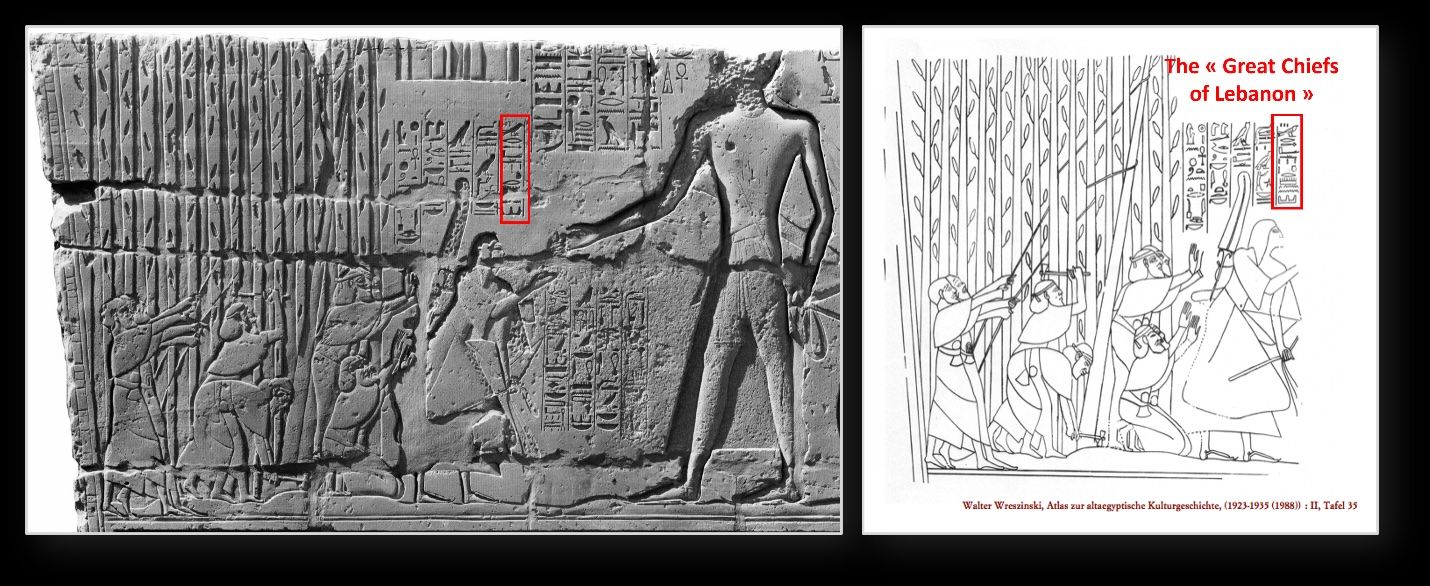
The “Great chiefs of Lebanon” cutting trees for Sethi I, Temple of Amon in Karnak, bas-relief on the outer northern facade of the hypostyle room. © Archive Nicolas Grimal.

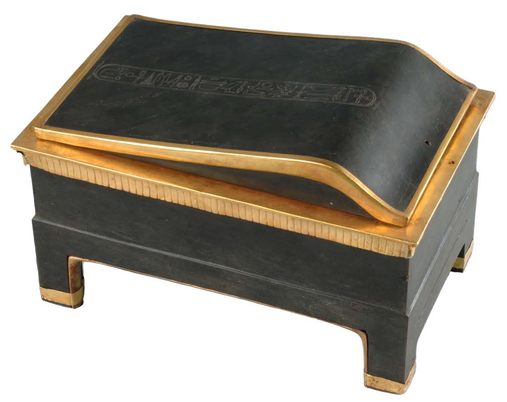
Byblos became Egypt’s indispensable partner. Seti I’s bas-relief depicts the “Great Chiefs of Lebanon” felling trees for the Pharaoh, thus bearing witness to these trade transactions between Byblos and Egypt in the second millennium BCE. Later, the 11th century BCE story of Wenamun, an Egyptian high dignitary sent to Byblos by Pharaoh Ramses XI to buy wood to repair Amon’s sacred vessel in the temple of Thebes, highlights the continuing timber commerce with Byblos. Archaeological evidence illustrates the intensity of this connection with hundreds of Egyptian artifacts such as stone vessels and inscriptions bearing royal names uncovered in temples and tombs as early as the third millennium BCE.

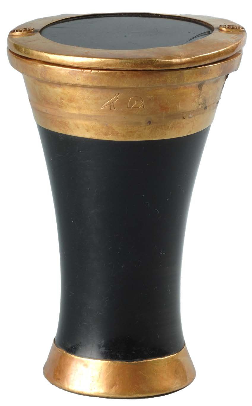
Obsidian and gold vase inscribed with the throne name of the Egyptian pharaoh Amenemhat III found in Royal Tomb I of local ruler Abishemou. DGA 17308 © Ministry of Culture, Lebanon/Directorate General of Antiquities.
Obsidian and gold box inscribed with the throne name of the Egyptian pharaoh Amenemhat IV found in Royal Tomb II of local ruler, Abishemou-Abi, son of Abishemou. DGA 17299 ©Ministry of Culture, Lebanon/Directorate General of Antiquities.
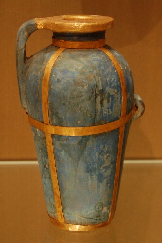
Egyptian blue faience vase set in gold dated to the Middle Bronze Age. National Museum of Beirut. Photo: Hanan Charaf.
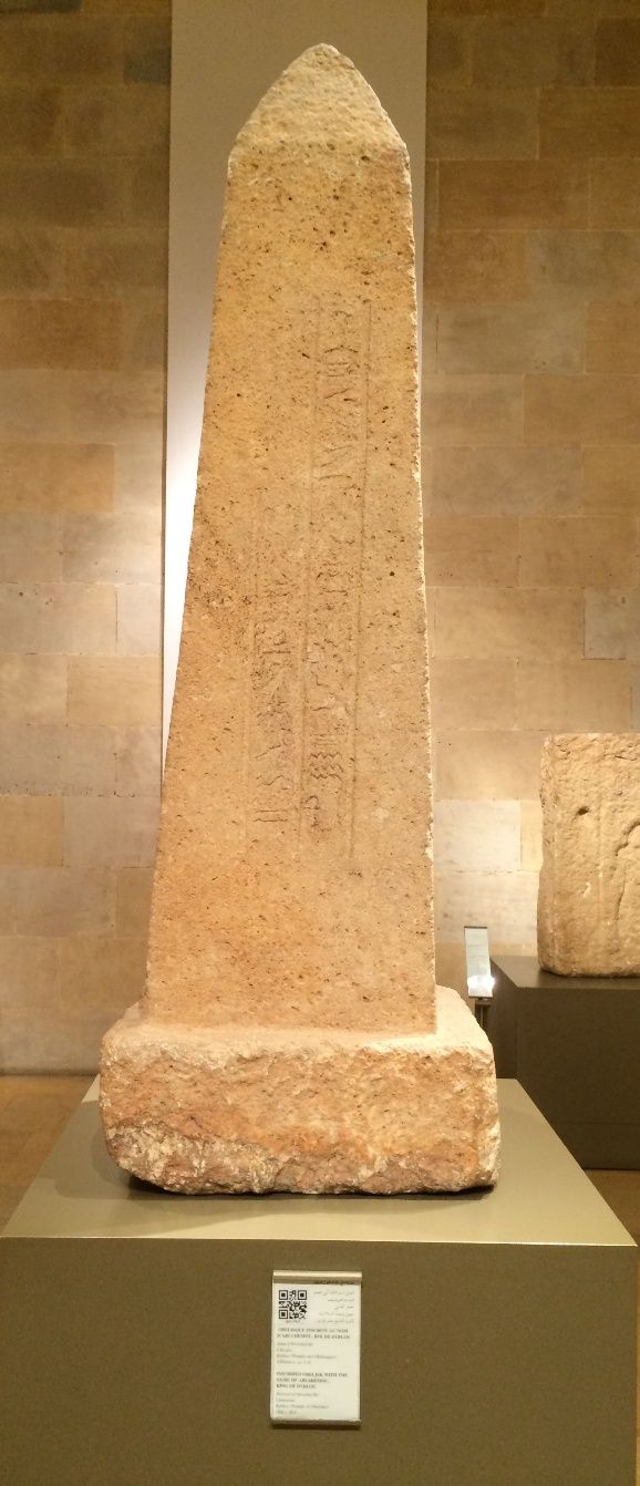
Obelisk found in the Obelisk Temple bearing a hieroglyphic inscription dedicated by King Abishemou, beloved of Herishef-Rê. National Museum of Beirut. Photo: Hanan Charaf.
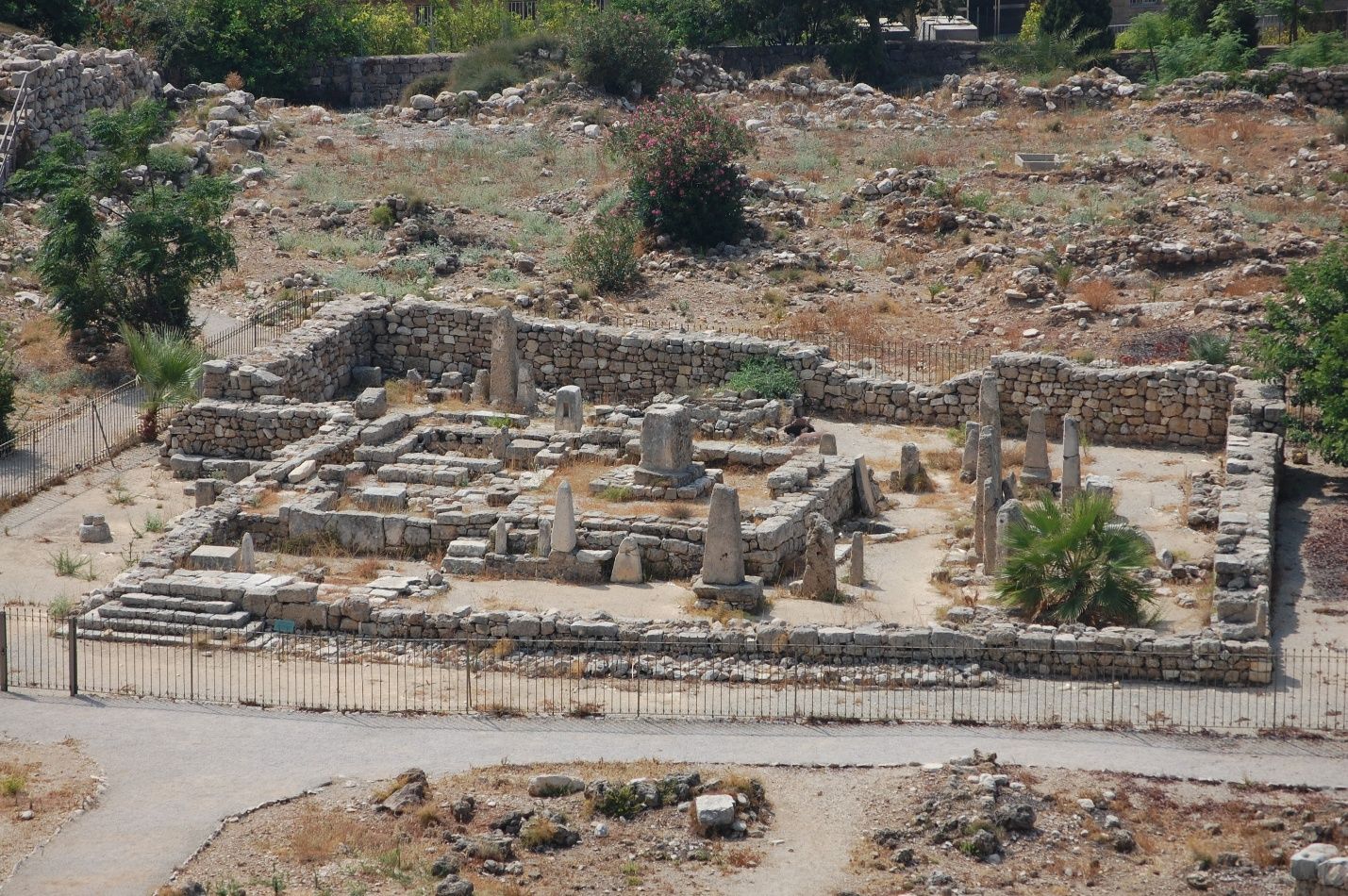
The Obelisk Temple where worshippers deposited obelisks and anchors to the local deity. Photo: Hanan Charaf.

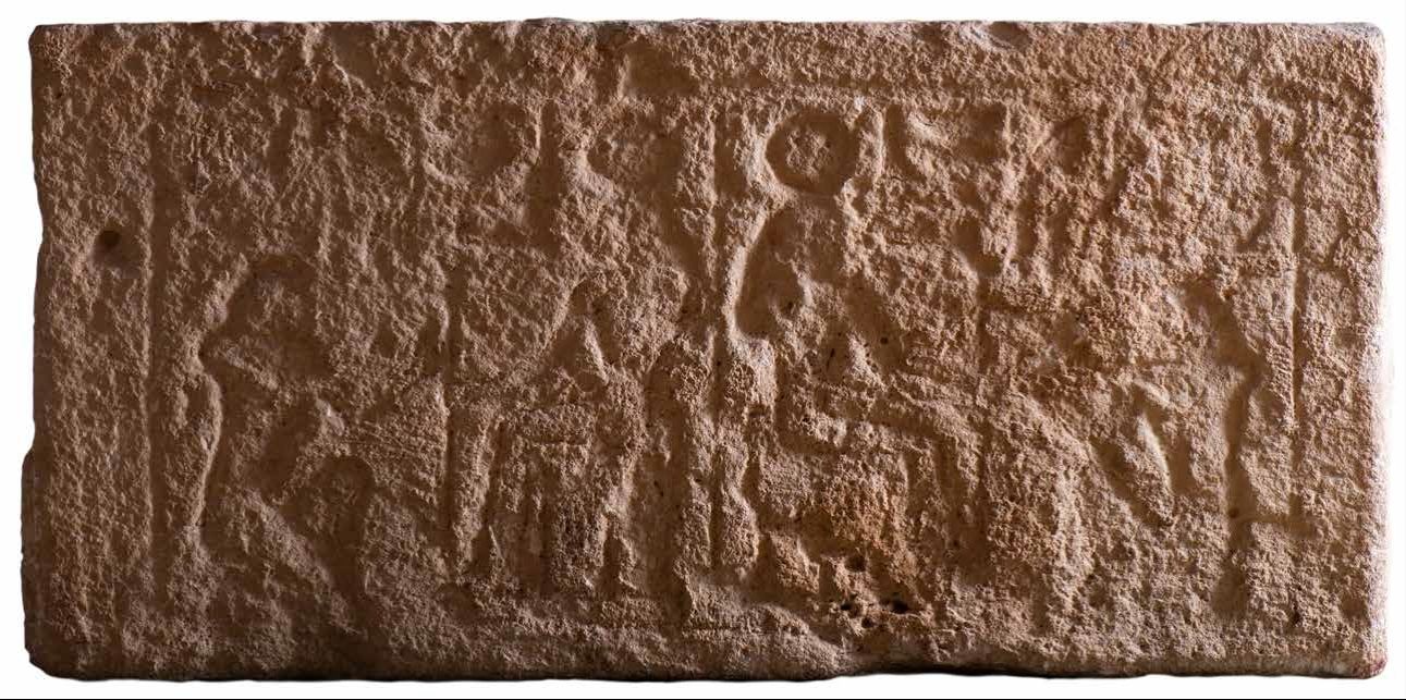
These strong ties are also evident in the local material culture of Byblos, where Egyptian motifs appear in art, hieroglyphic inscriptions are used in royal contexts, and religious practices show close parallels with those of Egypt. The city’s main deity, Baalat Gebal, was assimilated with the Egyptian goddess Hathor. At first glance, such features might be interpreted as evidence of Egyptian dominance at Byblos. Recent studies, however, point instead to selective cultural appropriation rather than Egyptian direct political control.

Baalat Gebal Temple dedicated to the chief goddess of Byblos. Photo: Hanan Charaf.
Carved stone lintel from Byblos depicting the goddess Hathor “Lady of Byblos” with a solar disk and horns. In front of her, a kneeling king, possibly Pepi I of the 6th Dynasty. The local goddess, Baalat Gebal, was conflated with Hathor. DGA 2028 ©Ministry of Culture, Lebanon/Directorate General of Antiquities.

The elites of Byblos adopted Egyptian symbols, titles, and artistic forms not out of subordination, but to enhance their own authority within a competitive environment where prestige mattered. Additionally, a large corpus of pottery vessels made with local clays but imitating Egyptian fabrics, uncovered in recent excavations, may suggest the presence of potential taverns and other establishments catering to Egyptian clientele such as sailors and merchants.  

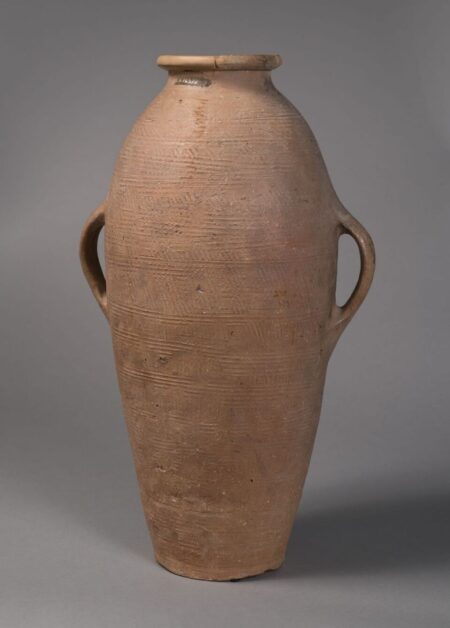
Yet the relationship with Egypt was not one-sided: Canaanite storage jars have been found in Egyptian contexts, including Tomb U-j at Abydos (c. 3300 BCE), which belonged to a local ruler. Byblos was thus not only a supplier of timber and resin; it was also a key hub in the exchange of luxury commodities. The city imported supplies such as gold, silver, ivory, and faience from Ancient Egypt, Syrian polities (Ebla?), and Cilicia, and helped circulate them across the region. It is believed that these commodities played an important role in shaping Near Eastern elite identity and in strengthening the position of local rulers within wider international networks. Researchers have also suggested that Mesopotamian motifs found in Egypt (on the Gebel al-Arak knife or the Narmer Palette) may have transited through direct or indirect exchange networks involving Byblos.

Combed jar from Edfu, 6th Dynasty, c. 2413-2250 BCE. Louvre E16577 © 2022 Musée du Louvre, Dist. GrandPalaisRmn / Christian Décamps.

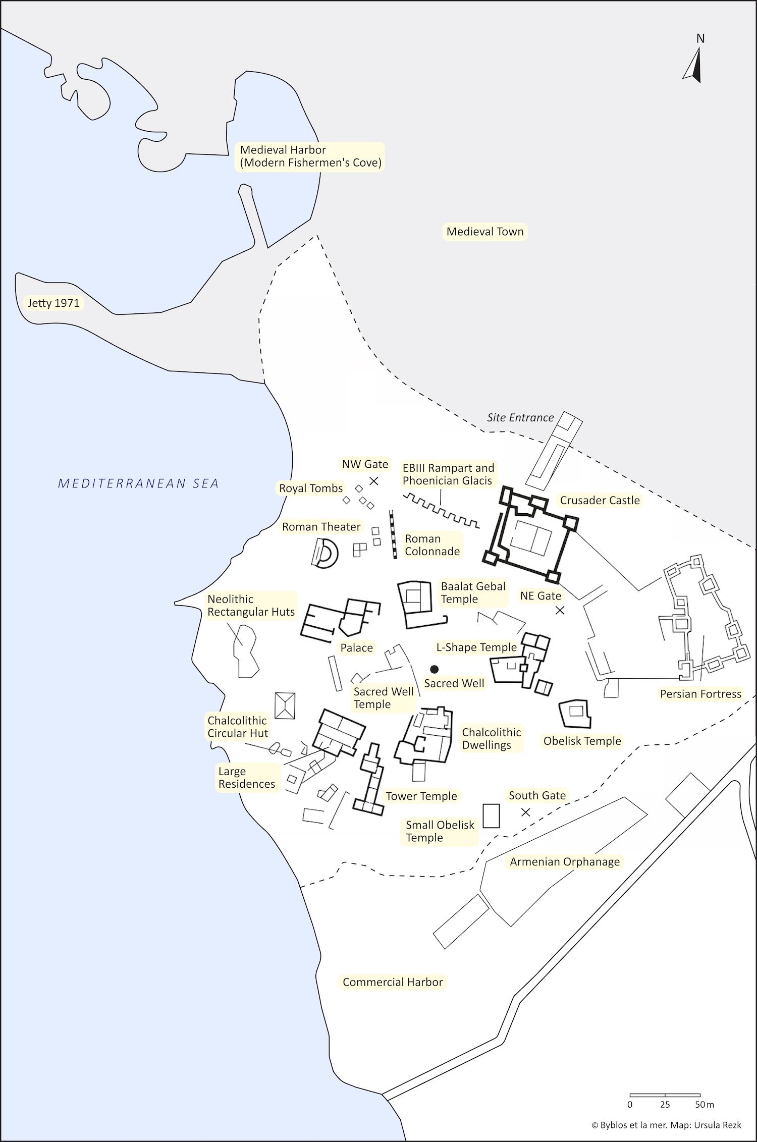
Within its walls, Byblos’ acropolis (from akron meaning top and polis, meaning city) or upper fortified city, was a compact city but carefully structured in at least seven neighborhoods. It contained the key urban institutions: temples, administrative buildings, and palaces organized around a central water point that served both a practical and symbolic focal point and was later monumentalized as a sacred well.

Byblos’ site plan showing the main structures excavated. Map: Ursula Rezk. © Archives Byblos et la mer.

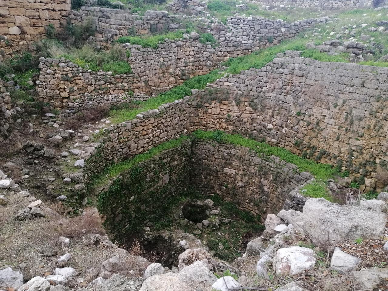
Recent studies have demonstrated that this water source was not a natural spring, as long thought, but rather a well with a human-engineered shaft dug at the center of the promontory, within a natural depression located at the lowest point between the two hills forming the headland, in order to tap into groundwaters fed by the numerous rivers of the hinterland. From this sacred well, streets radiated outward crossing three circular major arteries, in a pattern known from other Levantine cities such as Tell Arqa in northern Lebanon. Narrow alleys connected residential areas, while broader routes linked the interior to the city gates and, ultimately, to the sea. The fortifications that enclosed this space were equally significant. Massive walls and glacis protected the settlement, particularly on the eastern landward side, where threats were most likely to emerge.

The Sacred Well accessed by a spiral man-made staircase. © Ministry of Culture, Lebanon/Directorate General of Antiquities.
The Early Bronze Age III (2750-2500 BCE) indented rampart followed by a succession of multiple glacis dated to the Bronze and Iron Age. The Crusader Castle was built atop these ancient fortifications. © Ministry of Culture, Lebanon/Directorate General of Antiquities.

Monumental gates with multiple wooden doors regulated access, controlling the flow of traffic between the acropolis, the lower city, and the sea. Two harbors facilitated fishing and maritime activity, while royal and elite cemeteries often located near gates reflected social hierarchies and ritual practices. The placement of tombs was not arbitrary; it expressed distinctions of status and proximity to power sites (palace and temples). No burials of ordinary inhabitants have been found within the city’s limits, suggesting that the cemeteries of the general population were most likely located outside its walls, likely beneath the modern town of Jbeil.

Investigating Maritime Byblos

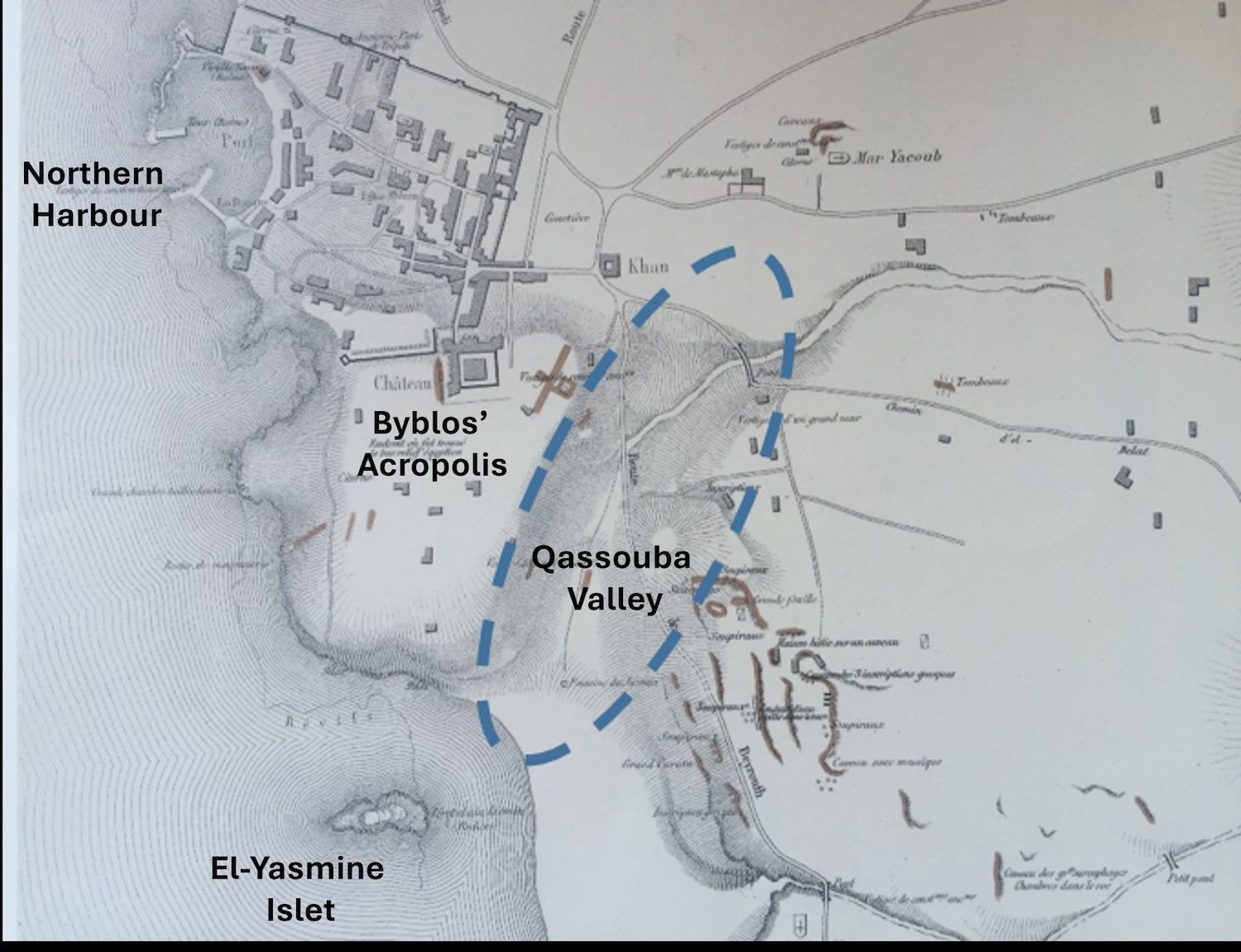
For more than 75 years, archaeological research at Byblos was primarily land-based, focusing on the ancient tell of Byblos. The coastline, notably the Qassouba Valley, located at the southern foot of the ancient tell, is highlighted by French Orientalist Ernest Renan in his 1860s work, Mission de Phénicie, as a natural shelter for ships due to its geography. In contrast, the northern harbor of Byblos was long thought to be the ancient city’s main mooring facility, an idea largely based on the 1930 aerial photographs taken by the French archaeologist Antoine Poidebard. This theory was later challenged by British pioneering figure Honor Frost, who argued that the northern harbor could only likely accommodate small vessels, making it suitable for a fishermen’s cove rather than for heavy cargo. Frost began conducting archaeological studies in the 1990s in search of Byblos’s ancient harbor. Initially unable to locate any substantial mooring facilities on the city’s seafront, she focused on submerged reefs, referred to as the “Dahret Martine,” anchorages located at 1.5 to 4 km offshore. These reefs were believed to host large ships, facilitating Byblos’ maritime trade via coasters or lighters for transporting goods. Discovery of pierced stone anchors at these sites supported Frost’s hypothesis.

E. Renan's plan (Plate XIX) of Byblos featuring the Acropolis overlooking the Qassouba Valley (blue dotted lines) and El-Yasmine Islet (Mission de Phénicie 1864-1874).

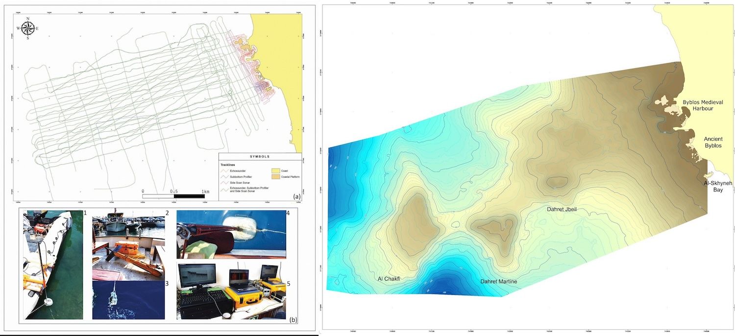
Carrying on Frost’s legacy after her passing in 2010, Martine Francis-Allouche and Nicolas Grimal have launched Byblos et la mer, an ongoing multidisciplinary research project that has conducted multiple remote-sensing surveys and archaeological field missions since 2011. This endeavor plotted the offshore approaches to Byblos to understand the role of the offshore reefs within the harbor system. Due to their exposure to the element, these reefs were probably used as temporary anchorages for ships awaiting mooring in Byblos’ commercial harbor. The handling of large timber logs, as mentioned in ancient texts, would have been challenging on ships anchored at sea.

Clockwise, from top left: Detailed bathymetric map of the three offshore reefs at Byblos; Detailed bathymetric map of the nearshore maritime area at Byblos. Remote sensing surveys of the maritime approaches to Byblos, showing the main equipment. Right: © Archives Byblos et la mer.

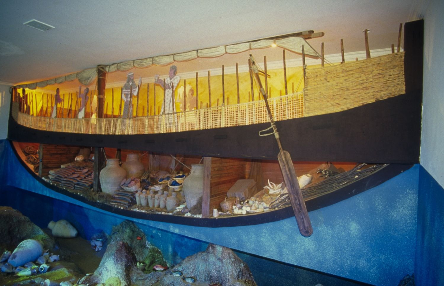
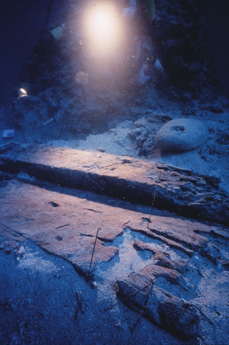
Modern coastal topographies do not accurately reflect past landscapes due to significant changes in sea levels, erosion or silting. Interdisciplinary geoarchaeological studies at Byblos, such as marine and terrestrial geophysical surveys, have revealed insights into the geomorphology and layout of the ancient shorelines and harbors. The Byblos et la mer Project undertook several investigations on the Armenian Orphanage lot in the Qassouba Valley. Surveys were conducted to evaluate the valley’s potential as a safe mooring basin for merchant ships such as the 15-meter-long Uluburun shipwreck (14th century BCE) and the 12-meter-long Cape Gelidonya shipwreck (13th century BCE).

Illustration of the Uluburun shipwreck model at the Bodrum Museum of Underwater Archaeology. Photo by Martine Francis-Allouche.
Keel of the Uluburun shipwreck, made of Lebanese cedar wood (with permission of Cemal Pulak © INA).

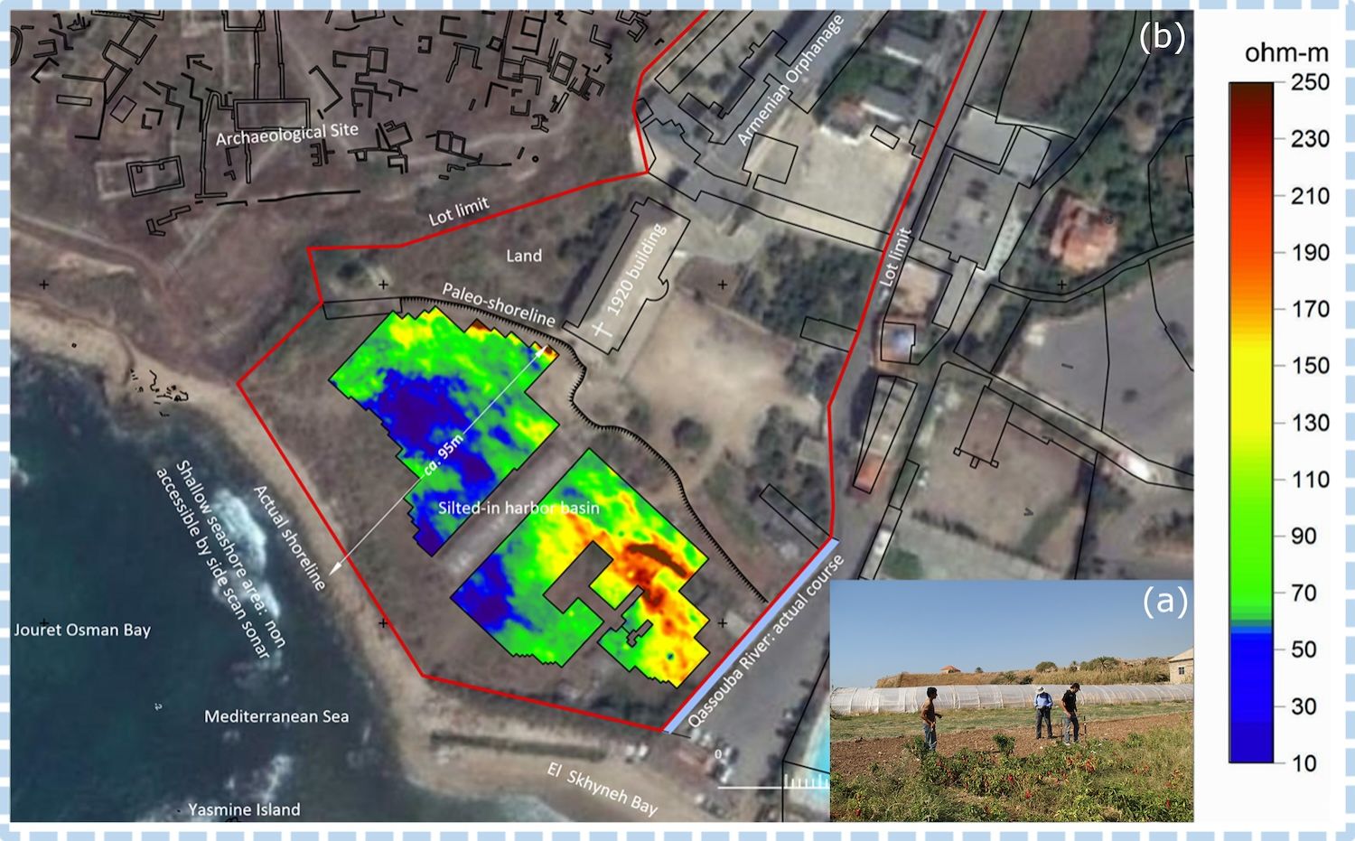
Geophysical surveys revealed a buried harbor basin and a palaeoshoreline located about 100 meters inland. The site’s topography afforded thus a substantial area of approximately 20,000 m² with an average water depth of 2.5 meters, suitable for large cargo vessels. Siltation of the harbor led to its eventual abandonment, with the definitive closure possibly linked to an earthquake in 551 CE. Current modern constructions have obscured remnants of the ancient southern harbor of Byblos and future archaeological research may reveal its presumed quays and other harbor facilities, as well as shed more light on the reasons behind its abandonment.

Aerial photograph showing a two-dimensional image of the buried basin in the lower Armenian Orphanage lot. Bottom right shows geophysical measurements taken on the lot. © Archives Byblos et la mer.
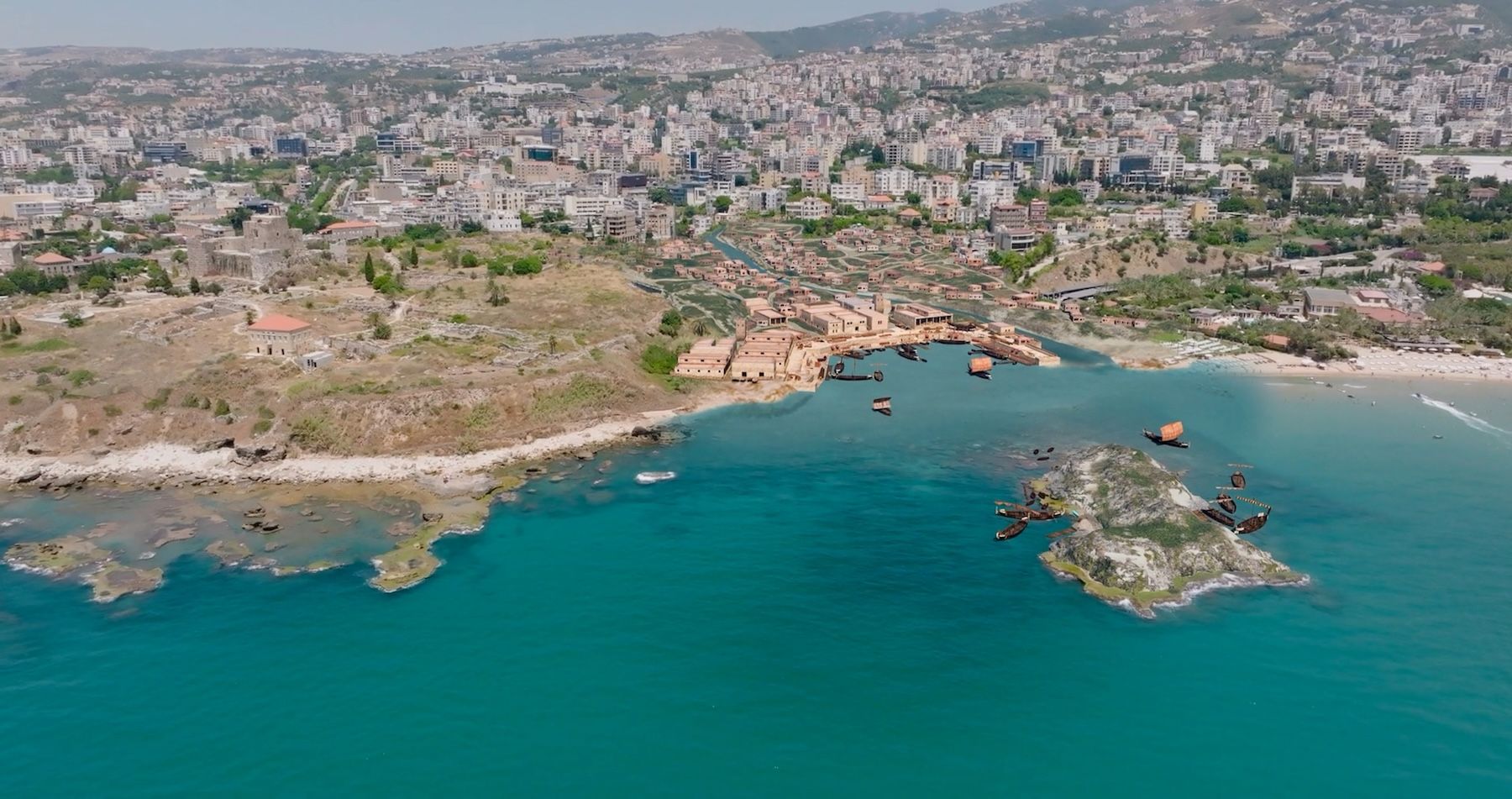
Southern harbor hypothetical reconstitution (© Gédéon Programmes – Drawing conception: Martine Francis-Allouche).

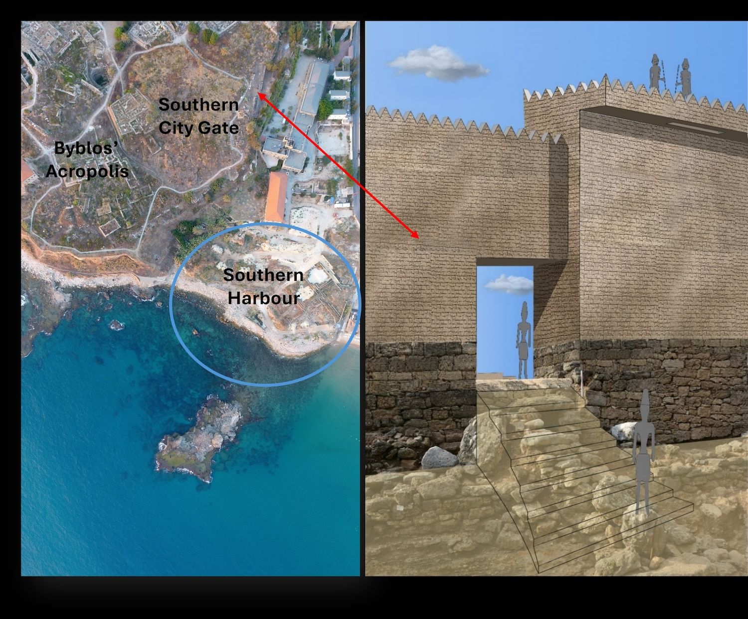
In addition to the underwater investigations, recent land excavations carried out by the Byblos et la mer Project on the southern fringes of the ancient tell have helped define the overall urban fabric of the ancient city and revealed the remnants of a once substantial fortified Middle Bronze Age city gate. This gate — dubbed the Southern Harbor Gate — provided access to the lower city and its large harbor, which accommodated seagoing merchantmen, as described in the Wenamun story.

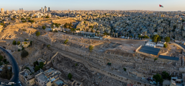
Left: Aerial photography of the Byblian Acropolis, showing the location of the Southern Harbor Gate, overlooking the newly located harbor basin. Photo: Rami Yassine. © Archives Byblos et la mer. Right: Hypothetical digital reconstitution of the Southern Harbor Gate. © Archives Byblos et la mer.

Various mooring and anchoring sites around ancient Byblos have now been identified, featuring a complex harbor system with two primary facilities. The northern cove served the fishing community and facilitated short-distance transportation, while the southern harbor was deeper and more suited for larger commercial vessels. This southern harbor likely included an outer facility located in the Bay of Jouret Osman, shielded by El-Yasmine Island from the prevailing south-western winds, and a nearby Dahret Martine offshore anchorage for ships awaiting to be moored at the Bronze Age harbor of Byblos. The sandy El-Skhyné Bay could have served for handling operations, such as transshipment, goods storage and probably as a shipyard area. This complex mooring system would have fulfilled the trade needs of this maritime city, most likely the ancient city’s economic hub over millennia.

Future Byblos et la mer archaeological investigations will focus on the harbor basin’s configuration and potential structures. The project’s findings necessitate thus extending the limits of Byblos southward to include the newly identified harbor area, ensuring its protection within the archaeological perimeter in accordance with its status as a UNESCO World Heritage Site.  

Byblos’s connection to the sea was not incidental. It was fundamental. The city’s sophisticated dual harbor system illustrates a nuanced understanding of maritime needs. The acropolis, nestled on top of a promontory, overlooked a lower town with the southern and northern harbors on either side, as well as a valuable hinterland with dense conifer forests and the vital presence of the surrounding valleys and rivers, which served as ancient routes and transportation axes. Ancient Byblos owes its spectacular growth and remarkable rise during the Bronze and Iron Ages to this global harbor system which served, among others, the cities’ lucrative timber export over millennia. This land arrangement suggests a division of labor within the urban economy. Local subsistence activities such as pottery making, jewelry craftsmanship, and metalworking coexisted in the city with international commerce and were each supported by distinct infrastructures such as industrial quarters attached to the temples. Together, they sustained the city’s population and its interregional trade connections.

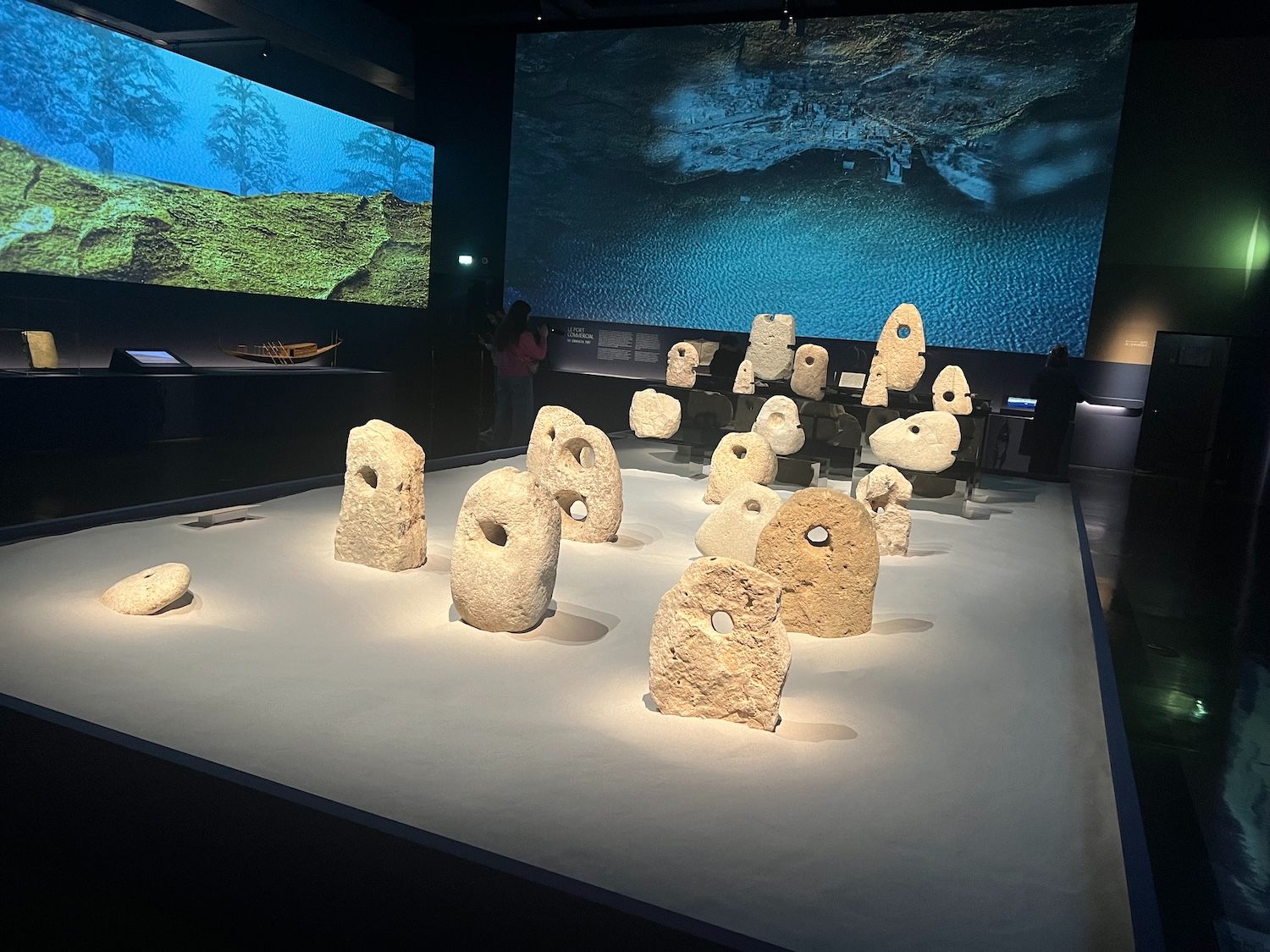
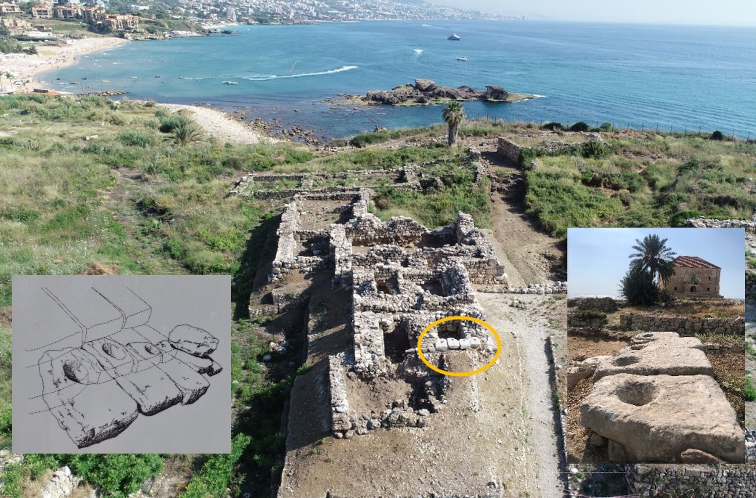
The sea also shaped the mental world of Byblos’ inhabitants. In religious contexts, the sea’s strong symbolism frequently represented sacred protection against the sea’s unpredictable and chaotic nature. Stone anchors, which are typically used for navigation, were deposited as offerings or ex-votos in the city’s various temples on the site, sometimes even being integrated into their structures. These anchors took on a symbolic meaning here, expressing hopes for safe journeys or gratitude for survival.

Byblos anchors (above) exhibited at the Institut du Monde Arabe: Byblos, cité millénaire (Paris, March 24-August 23, 2026). Photo: Martine Francis-Allouche.
Six votive anchors (below) forming the threshold of the Tower Temple. © Archives Byblos et la mer.

Unlike the great territorial states of the Bronze Age, Byblos did not build an empire. Its influence rested on something less visible but equally effective: its position within networks. Texts from the Late Bronze Age, including the famous Amarna letters, reveal a world of diplomacy and negotiation. The ruler of Byblos appears as a correspondent of the Egyptian pharaoh, requesting assistance, affirming loyalty, and navigating a landscape of competing interests. What emerges is a picture of a city adept at survival. Rather than relying on military strength, it leveraged its economic and strategic importance. Its role as an intermediary ensured that it remained relevant, even as political configurations shifted over time.

Hanan Charaf PhD, is an associate professor of art and archaeology at the Lebanese University. She is also the Director for North African Cultural Heritage Projects at ASOR.

Martine Francis-Allouche PhD, is a marine archaeologist, affiliated Researcher at Collège de France, and Director of the research project “Byblos et la mer”. She is also an ICOMOS-ICUCH member.

Byblos, cité millénaire du Liban is on display at Institut du Monde Arabe in Paris until 23 August 2026.

Suggested further reading:

Byblos, A Legacy Unearthed. 2024. Edited by the National Museum of Antiquities (the Netherlands), Ministry of Culture/Directorate General of Antiquities (Lebanon). Sidestone Press, Leiden. [Open access]

Charaf, H. 2026. “Les relations entre Byblos et l’Égypte durant l’âge du Bronze (3300-1200 av. J.-C.),” in Byblos. Cité millénaire, Editions Sans Egal, Paris, 110–121.

Charaf, H. 2024. “The Relations between Byblos and Egypt during the Middle Bronze Age,” in Byblos, A Legacy Unearthed, Sidestone, Leiden, 123–128.

Charaf, H. 2021. “La céramique de l’âge du Bronze de Byblos – Projet Byblos et la Mer,” Bulletin d’Archéologie et d’Architecture Libanaises 21, 208–244.

Charaf, H. and Francis-Allouche, M. 2026. “Byblos à l’âge du Bronze, une métropole maritime,” in Byblos. Cité millénaire, Editions Sans Egal, Paris, 74–81.

Montet, P. 1928. Byblos et l’Égypte, Bibliothèque Archéologique et Historique 11, Geuthner, Paris.

Francis-Allouche, M. 2025. Byblos et la Mer. Les abords maritimes et le système portuaire antique. Mémoires de l’Académie et Inscriptions et Belles-Lettres, Tome 65, Peteers.

Francis-Allouche, M. and Grimal, N. 2016. “The Maritime Approaches to Ancient Byblos (Lebanon),” Journal of Eastern Mediterranean Archaeology and Heritage Studies 4(2–3), 242–277.

Saghieh, M. 1983. Byblos in the Third Millennium B.C. Warminster, London.

Zaven , T. (ed.) 2026. Byblos, Cité millénaire du Liban. Editions Sans Égal, Paris.
How to cite this article:

Charaf, H. and Francis-Allouche, M. 2026. “Byblos and the Making of an Ancient Maritime Hub”, The Ancient Near East Today 14.6. Accessed at: https://anetoday.org/byblos-maritime-hub/.

Want to learn more?

1 Comment

  • Deborah A Walsh

    I have had the pleasure to go to Byblos 4 times now as I’m in Lebanon working with Syrian refugees and sharing the gospel It is something to see so I appreciated the article and insights.

Post a comment

Your email address will not be published. Required fields are marked *